SITUACIÓN: Provincia de Lleida - Val d ' Aran- Desde de Bossòst coger la rotonda de la carretera N-230 y N-141 subir hasta el Portillón son 8 km., estacionar en el pequeño parquin y bajar por la carretera unos 300 metros hasta coger la pista forestal del Clot de Baretja, por donde transcurre parte del PR-115, seguir este sendero hasta el Clot de Baretja.
DESCRIPCIÓN: Siguo el PR-115 hasta el Clot de Baretja llego a la muga nº 356 y desde aquí ataco el Tuc deth Plan dera Serra donde llego a las 11:44 horas, me repongo del esfuerzo y todo unas fotografías e inicio el descenso llegando al Portillón por el mismo itinerario de subida.
REFERENCIA: Mapa excursionista Editorial Alpina: Val d'Aran Escala 1:25.000.
CURIOSIDADES: En la zona hay cobertura telefonía móvil, en el Clot de Baretja entran los repetidores franceses. Mejor llevar el agua desde el inicio.
Nota de autor: Las fotografías están tomadas con una cámara digital OLYMPUS Camedia de 3.2 Megapixel.
© nudels Tots els drets reservats
-----------------------------------------------------------------------------------------------------
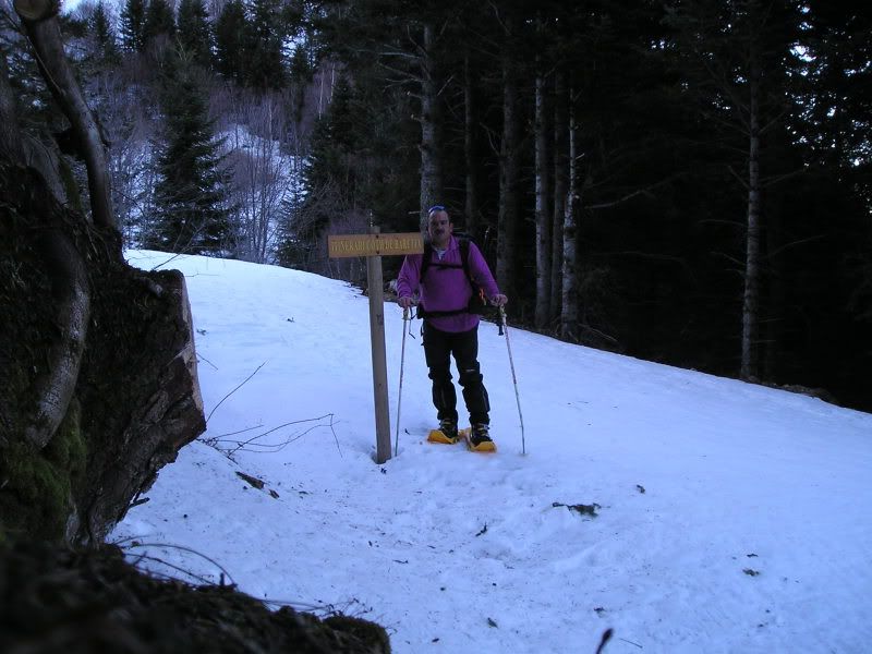
09h47: Dejo el vehículo en el pequeño parquin del Col deth Portilhon (Puerto o collado del Portillón).
DESCRIPCIÓN: Siguo el PR-115 hasta el Clot de Baretja llego a la muga nº 356 y desde aquí ataco el Tuc deth Plan dera Serra donde llego a las 11:44 horas, me repongo del esfuerzo y todo unas fotografías e inicio el descenso llegando al Portillón por el mismo itinerario de subida.
REFERENCIA: Mapa excursionista Editorial Alpina: Val d'Aran Escala 1:25.000.
CURIOSIDADES: En la zona hay cobertura telefonía móvil, en el Clot de Baretja entran los repetidores franceses. Mejor llevar el agua desde el inicio.
Nota de autor: Las fotografías están tomadas con una cámara digital OLYMPUS Camedia de 3.2 Megapixel.
© nudels Tots els drets reservats
-----------------------------------------------------------------------------------------------------
09h47: Dejo el vehículo en el pequeño parquin del Col deth Portilhon (Puerto o collado del Portillón).

10h06: Subo por PR -115 que coincide en algún tramo con la piesta forestal y llego al Pla dera Bruixes.

11h42: Y tirand con fuerza por el PR-115 llego al final del bosque.
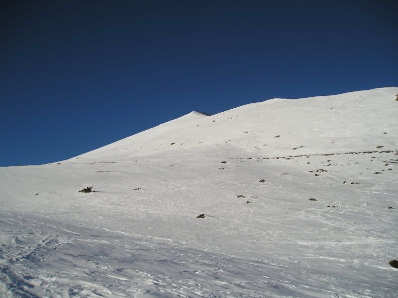
10h56: Y ya ve o mi objetivo Tuc deth Plan dera Serra (1978 metros).
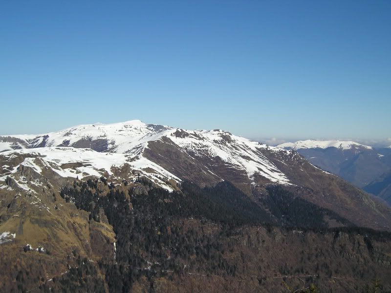
11h03: Voy subiendo hasta el Clot de Baretja y se descubre un paisaje impresionante.
11h03: Y conuna mirada atrás veo parte del cordal fronterizo.

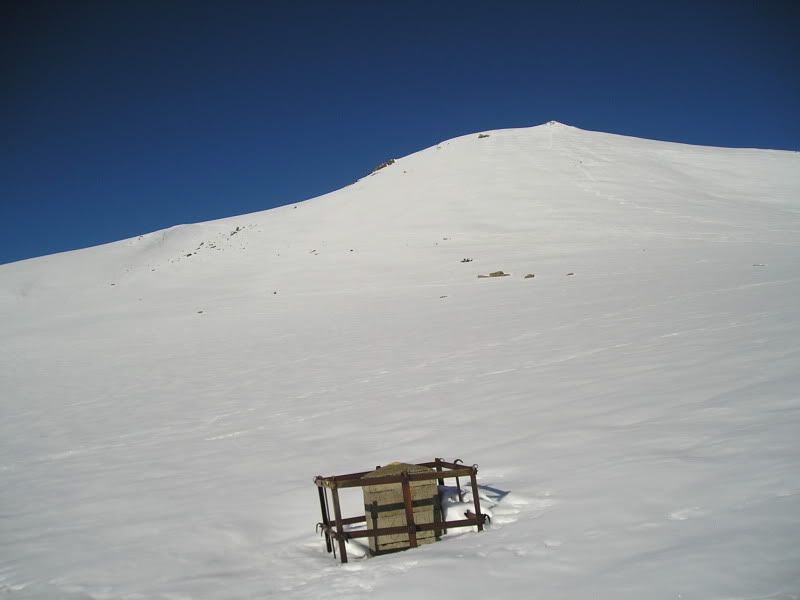
11h08: Ya veo la muga nº 356 situada en el Clot de Baretja, tengo que acercarme hasta ella.
11h09: Bueno ya estoy aquí, además enfrente tengo el Tuc deth Plan dera Serra tengo que subir hasta allí arriba.
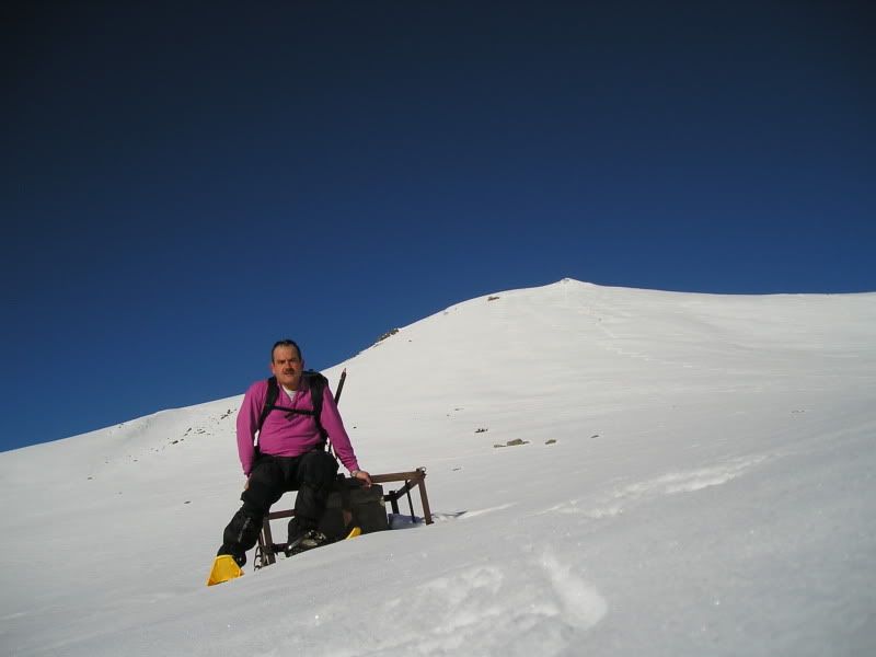
11h10: Pero antes una fotografía junto a la muga.
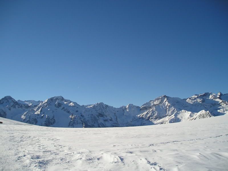
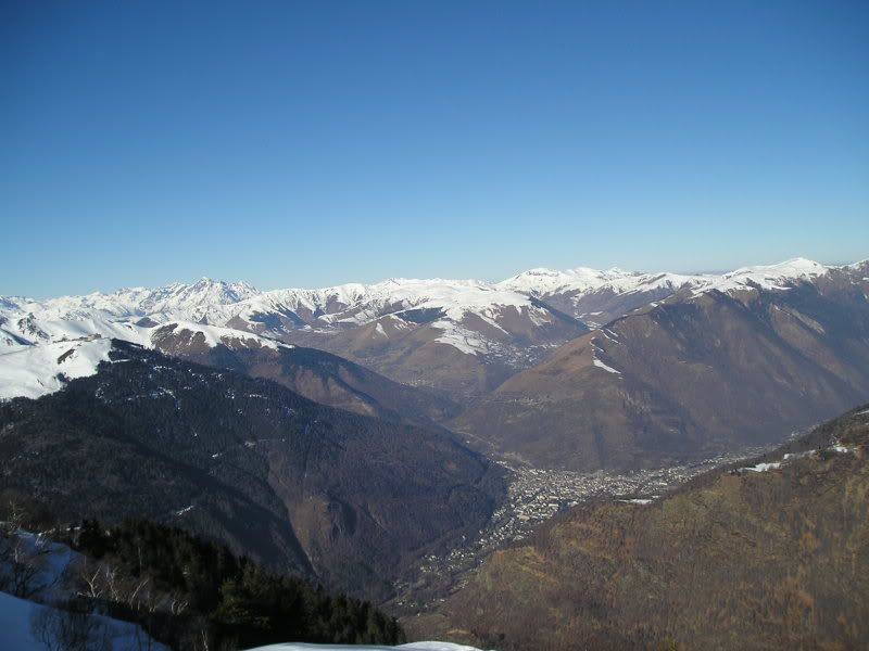
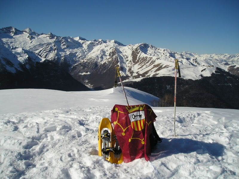
11h44: Y llego al Tuc deth Plan dera Serra (1978 metros), desde aquí tengo unas impresionates vistas, por ejempo de Bagneres de Luchon o Luchon.
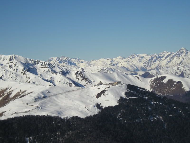
11h44: O de la piesta de esquí francesa de Superbagneres.
11h44: O el Boum, el Maupas o Crabioules.
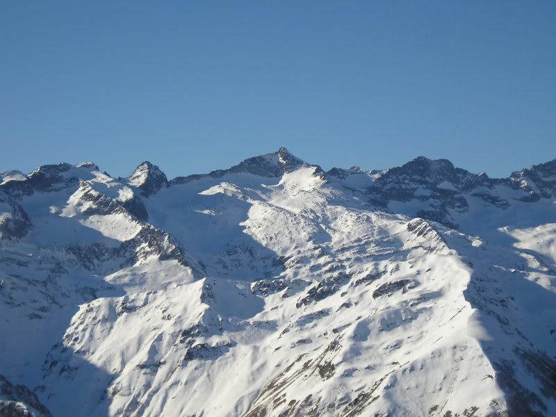
11h44: O esta otra.
11h44: O ésta.
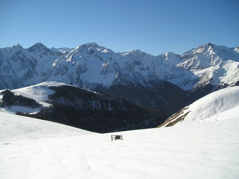
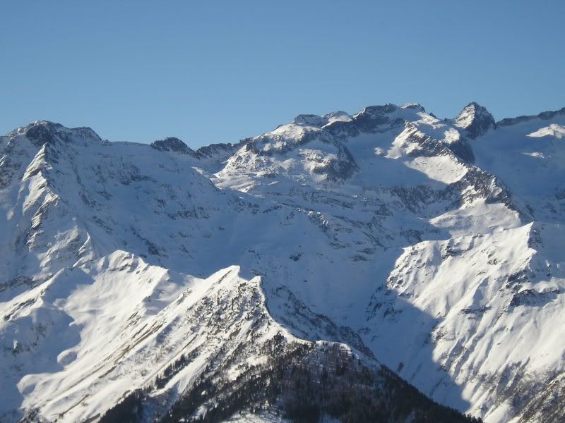
11h45: Y aquí la parte de la Val d'Aran y al fondo Francia.
11h46: Bueno y aquí otra fotografía en la cima.

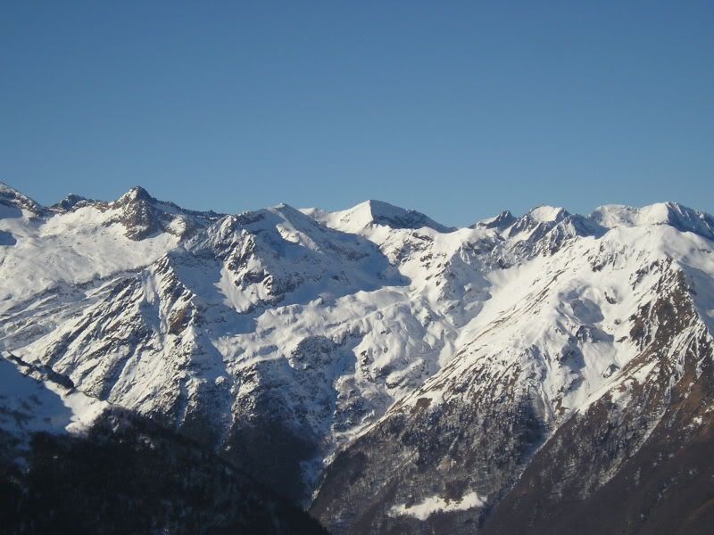
12h06: El Tuc d'Aubas y el Tuc d'Arres.

12h06: Portillón (Portilhon) y el cordal fronterizo.
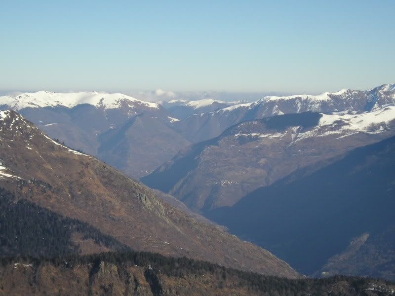
12h07: Y la zona francesa de Campsaure.

12h18: Y esta par finalizar.


No hay comentarios:
Publicar un comentario